


FEMA Draft Flood Maps for Harris County: What It Means for Your Project
- Feb 11
- 6 min read
Updated: Mar 14

After years of delay, FEMA’s updated floodplain mapping for Harris County is finally moving from internal review toward public release, following a process that began soon after Hurricane Harvey in 2017. Local officials have pressed FEMA repeatedly to expedite these maps because they will significantly expand and redefine high‑risk flood zones across the Houston region.
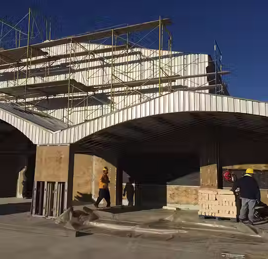
For landowners, developers, lenders, and public agencies, the draft maps are not just lines on a page—they affect where you can build, how you must design, and what flood insurance you will pay. In this shifting landscape, JRH Engineering & Environmental Services is the premier provider of Civil engineering and Structural engineering design Solutions in the states of Texas, North Carolina, and Florida. Our team helps clients understand new risk, stay compliant, and keep projects “Done Quickly. Done Right. And for the Best Value.”
Why FEMA’s New Harris County Maps Matter
Years of delay and rising risk
FEMA and the Harris County Flood Control District (HCFCD) began a total overhaul of the county’s mapped floodplains around 2018 to reflect post‑Harvey data, improved rainfall statistics, and better modeling. Key points:
The last comprehensive floodplain update for Harris County dates back to 2007.
New maps were originally expected around 2022, then 2023, then “sometime in 2024–2025,” slipping multiple times.
County officials have warned that these repeated delays hinder public safety and informed decision‑making on billions of dollars in new construction each year.
Despite the lag, draft mapping and MAAPnext data indicate that the 100‑year floodplain acreage is likely to grow significantly, reflecting more intense rainfall and improved understanding of flood behavior.
What the draft maps will influence
Once FEMA’s preliminary Flood Insurance Rate Maps (FIRMs) are released and move through appeal and adoption, they will shape:
Flood insurance requirements for federally backed mortgages.
Elevation and mitigation requirements for new construction and substantial improvements.
Drainage and detention expectations under Harris County and city criteria.
Perception of risk used by investors, insurers, and public agencies.
JRH helps clients track this evolution and plan projects that work both under current effective maps and under likely future conditions.
Understanding Floodplain Designations in Harris County
100‑year vs. 500‑year floodplains
Flood maps designate:
Special Flood Hazard Areas (SFHAs)—commonly called the “100‑year floodplain”—where properties have a 1% annual chance of flooding; these areas often trigger mandatory flood insurance for many loans.
500‑year floodplains, with a 0.2% annual chance; these areas have historically been treated as lower‑risk but saw serious flooding during Harvey.
Early statements from county engineers indicate the mapped 100‑year floodplain could expand from roughly 150,000 acres to around 200,000 acres once the new methodology is fully applied. That means thousands of parcels not previously mapped into a high‑risk zone may see new requirements and insurance expectations.
Data tools already in use
Even before FEMA’s official preliminary FIRMs, Harris County has invested heavily in:
The MAAPnext program, producing forward‑looking inundation modeling and risk mapping.
The Harris County Flood Education Mapping Tool, which helps residents and professionals explore current and modeled risk scenarios.
JRH uses FEMA’s Map Service Center together with MAAPnext and county tools to evaluate both current regulatory status and emerging risk for each project site.
How Draft Flood Maps Impact Development and Design
1. Land development feasibility and entitlement
As floodplains expand and deepen:
More land may fall into SFHAs, affecting how much of a site can be economically developed.
Fill, elevation, and compensatory storage requirements may tighten, especially near bayous and channels.
Regional detention projects and buyout programs may reshape local drainage basins.
JRH’s Land Development Services help:
Screen candidate sites against current and draft flood data.
Compare conceptual layouts with likely detention, elevation, and access constraints.
Flag “red‑flag” parcels where future maps could make development uneconomical.
2. Civil engineering for drainage, detention, and access
Harris County and local cities already apply stringent drainage and stormwater criteria based on Atlas‑14 rainfall and updated hydrology. With new FIRMs, we expect continuing emphasis on:
Larger detention volumes per acre of new impervious cover.
No‑adverse‑impact standards verified through detailed modeling.
More attention to overflow routing, safe access, and evacuation routes during storms.
JRH’s Civil Engineering Services and Storm Water Compliance Design teams design:
On‑site retention/detention ponds sized for new rainfall and floodplain expectations.
Infiltration trenches and low‑impact development features where feasible.
Roadway and driveway elevations that maintain access under realistic flood scenarios.
3. Structural engineering in mapped floodplains
For structures in or near SFHAs, foundations and superstructures must account for:
Flood loads, buoyancy, and scour where applicable.
Elevation above base flood elevation (BFE) plus required freeboard.
Compatibility with windstorm engineering for hurricane‑prone Gulf Coast conditions.
JRH’s Structural Engineering Services and Foundation Engineering Design Services support:
Elevated slabs, piers, and piles tailored to local flood depths and soils.
Integrated wind‑and‑flood load paths from roof to foundation.
Designs that meet city, county, and (where relevant) Texas windstorm insurance requirements.
Why Choose JRH for Floodplain‑Sensitive Projects
Deep Texas floodplain and coastal experience
JRH has a strong track record of work in Gulf Coast and flood‑sensitive regions, including Harris County, Brazoria County, and Fort Bend County. Our published guidance on “Building in the TX Floodplain Area” highlights services such as:
Floodplain analysis and preliminary site assessments.
Environmental impact assessments and permitting support.
City and county coordination with agencies like TCEQ and local floodplain administrators.
We are also featured as a concierge flood‑focused engineering partner for Texas Gulf Coast projects, emphasizing floodplain and windstorm design.
Multi‑disciplinary, one‑stop solutions
From the JRH home page and service descriptions:
We offer Civil, Structural, and Environmental Engineering plus Land Development in TX, NC, and FL.
Our capabilities include SWPPP design, stormwater compliance, retention/detention, infiltration trenches, and site environmental assessments.
We are a Certified WBE, HUB, and WOSB, with decades of combined experience and strong local permitting knowledge across the Houston region.
This combination allows JRH to handle:
Floodplain analysis and feasibility.
Hydrologic/hydraulic modeling and detention design.
Structural and foundation engineering in high‑risk zones.
Permitting and certification support through city, county, and federal processes.
Our commitment: “Done Quickly. Done Right. And for the Best Value.”
In a mapping environment where uncertainty and delay have already stretched for years, JRH focuses on:
Quickly identifying how draft and future FIRMs will influence your site.
Getting it Right by aligning designs with both current regulations and emerging best practices.
Delivering the Best Value by helping you avoid stranded investments and costly redesigns as maps evolve.
Common Questions About FEMA’s Harris County Flood Maps
“When will FEMA’s new Harris County maps actually be effective?”
FEMA and HCFCD began the remap around 2018; full public availability has been pushed multiple times from 2022 into the mid‑2020s.
After FEMA releases preliminary FIRMs, there is a formal appeal and comment period, then adoption before they become effective.
In practice, developers and agencies are already relying on MAAPnext and county tools as a preview of likely future conditions.
JRH monitors FEMA and HCFCD announcements and helps clients plan to be resilient under both current and forthcoming maps.
“Will my property be moved into a higher‑risk flood zone?”
Early county discussions suggest the mapped 100‑year floodplain acreage will increase significantly, meaning some properties currently outside SFHAs may be added.
Tools like the FEMA Map Service Center, Harris County Flood Education Mapping Tool, and MAAPnext can help visualize current and modeled risk.
JRH can review your parcel using these tools and advise on design, insurance expectations, and long‑term strategy.
“How do the new maps affect permitting and design standards?”
Even before the new FIRMs are effective, Harris County and local jurisdictions have:
Adopted Atlas‑14‑based rainfall and updated stormwater criteria.
Strengthened requirements for detention, floodway encroachment, and no‑adverse‑impact modeling.
The new maps will further influence:
Where elevated finished floors, compensatory storage, or additional mitigation are required.
How lenders and insurers view project feasibility.
JRH integrates floodplain constraints into site planning, civil design, and structural engineering from day one to avoid late surprises.
“Can I still build in the floodplain?”
Yes, but projects in mapped floodplains must meet stricter design and permitting criteria, which may include:
Elevating structures above BFE plus required freeboard.
Providing compensatory storage for fill placement.
Designing foundations and utilities to withstand flood loads and scour.
Demonstrating no adverse impact to adjacent properties through modeling.
JRH has extensive experience permitting and designing projects in Texas floodplains, including Harris County.
Getting Ahead of the New Maps with JRH
For owners, developers, and agencies in Harris County, the key is to plan ahead rather than wait for final FEMA adoption. JRH can:
Screen sites using current FIRMs, MAAPnext outputs, and county tools.
Develop concept plans that work under both current and likely future floodplain boundaries.
Design civil and structural systems that enhance resilience and protect long‑term value.
Guide permitting with city, county, and state agencies for floodplain development.
To discuss how FEMA’s draft flood maps may affect your Harris County project, contact JRH via our website or call for a free consultation.
JRH Engineering & Environmental Services is the premier provider of Civil engineering and Structural engineering design Solutions in the states of Texas, North Carolina, and Florida. In the face of evolving flood risk and mapping, we help you build projects that are compliant, resilient, and “Done Quickly. Done Right. And for the Best Value.”


Comments