


Role of Civil Engineers for Land Subdivision Projects in TX, NC, & FL
- Jun 25, 2025
- 5 min read

The Role of Civil Engineers in Streamlining Land Subdivision Projects in Texas, North Carolina, and Florida
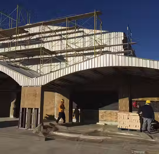
As the premier provider of civil engineering, structural engineering, and environmental engineering services in North Carolina, Florida, and Texas, JRH Engineering & Environmental Services plays a crucial role in streamlining land subdivision projects across three of America's fastest-growing states.
With Texas adding 562,941 residents in 2024, North Carolina growing by 164,835 people, and Florida maintaining its position as a top destination for domestic migration, the demand for efficiently subdivided land has never been higher123.
In this dynamic environment, civil engineers serve as essential partners in transforming complex regulatory landscapes into profitable, compliant development opportunities.
Regional Growth Driving Subdivision Demand
Unprecedented Population Growth Across Three States
The South has experienced the highest average population growth of any U.S. region, with cities and towns showing growth rates ranging from 1.6% to 2.0% annually1.
This surge, particularly notable in Building in Coastal States like Florida and North Carolina, creates enormous pressure on existing infrastructure and drives demand for new residential and commercial developments.
Princeton, Texas, topped the nation with a remarkable 30.6% growth rate in 2024, exemplifying the explosive expansion occurring throughout the region1.
Economic Drivers Behind Development
The global real estate market is projected to grow at a compound annual growth rate of 6.2% from 2025 to 2030, reaching $5.852 trillion by 20304.
This growth is particularly pronounced in Texas, North Carolina, and Florida, where factors including business-friendly policies, lower costs of living, and diverse economic opportunities continue attracting both domestic and international migration2.
Civil Engineers as Project Streamliners
Site Assessment and Feasibility Analysis
Civil engineers begin land subdivision projects with comprehensive site evaluations that determine project viability and optimal design approaches5.
This critical phase includes analyzing soil composition, topography, drainage patterns, and proximity to existing infrastructure6.
For coastal projects, engineers must also assess flood risks, hurricane exposure, and compliance with specialized regulations governing Building in Coastal States development.
Regulatory Navigation and Compliance
The subdivision process varies significantly across Texas, North Carolina, and Florida, requiring specialized knowledge of state-specific requirements:
Texas Requirements
All development must occur on legal lots or platted parcels7
Four statutory requirements for plat approval: accurate metes and bounds description, location relativity to parent tract, exact dimensions, and property owner acknowledgement7
County exemptions include the 10-acre exemption allowing subdivision into tracts of 10+ acres without public right-of-way dedication7
North Carolina Regulations
Florida Compliance
Environmental Resource Permits required for projects affecting wetlands or surface waters10
Stormwater discharge permits mandatory for developments disturbing more than one acre10
Special flood hazard area regulations requiring elevation certificates and compliance with Base Flood Elevation standards11
Technology Integration for Enhanced Efficiency
Geographic Information Systems (GIS) Applications
Modern civil engineers leverage GIS technology to revolutionize subdivision planning and design. GIS enables precise site selection by analyzing topography, soil quality, utility proximity, and transportation networks12.
This data-driven approach helps minimize risks and optimize lot configurations for maximum value13.
Building Information Modeling (BIM) and Drone Technology
The integration of drone surveying with BIM creates unprecedented accuracy in subdivision design.
Drones equipped with LiDAR and photogrammetry sensors capture comprehensive site data that feeds directly into detailed 3D models14.
This combination reduces surveying time by 30-50% while providing millimeter-level accuracy for design decisions14.
Digital Mapping for Streamlined Approvals
Digital mapping technology eliminates the need to contact multiple data providers, reduces cross-referencing requirements, and enables clear visualization of project scope for planning departments15.
This streamlined approach can reduce permitting timelines by 15-30% compared to traditional methods16.
State-Specific Engineering Solutions
Texas: Managing Expansive Soils and Water Scarcity
Texas civil engineers address unique challenges including expansive clay soils that can swell up to 12% in volume and increasing water scarcity concerns.
With Texas counties issuing around 200 water-use restrictions in 2024, subdivision designs must incorporate water-efficient infrastructure and comply with Texas Water Development Board requirements17.
North Carolina: Environmental Stewardship and Growth Management
North Carolina's environmental regulations require careful balance between development and conservation.
Civil engineers design subdivision infrastructure that meets stormwater management requirements while preserving natural features.
The state's conservation subdivision ordinances in 51 counties emphasize open space preservation and sustainable design practices18.
Florida: Flood Mitigation and Hurricane Resilience
Florida's coastal environment demands specialized engineering for flood resistance and hurricane protection.
Civil engineers design subdivisions with elevated infrastructure, enhanced drainage systems, and materials specified for saltwater exposure.
Recent updates to the Florida Building Code require minimum freeboard of BFE plus 1 foot for dwellings in all flood zones19.
Infrastructure Design and Optimization
Utility Coordination and Phased Development
Civil engineers optimize subdivision layouts through strategic utility placement and phased development approaches.
This includes designing modular utility corridors that accommodate future expansion while minimizing initial infrastructure costs20.
Coordinated planning can reduce utility installation costs by 20-25% compared to ad-hoc approaches21.
Stormwater Management Innovation
Modern subdivision design integrates green infrastructure solutions including bioswales, permeable pavements, and constructed wetlands.
These systems can reduce stormwater runoff by 40-60% while providing recreational amenities and enhancing property values22.
Cost-Benefit Optimization
Civil engineers employ advanced modeling software to optimize grading designs, assess project constraints, and explore alternatives to determine the most cost-effective solutions23.
Automated grading optimization can reduce earthwork costs by 15-30% while improving overall site functionality.
Value Maximization Through Strategic Design
Market-Driven Lot Configuration
Civil engineers work with developers to create lot configurations that maximize market appeal while meeting regulatory requirements.
This includes analyzing demographic trends, housing demand patterns, and infrastructure capacity to optimize subdivision density and layout20.
Sustainability Integration
Sustainable subdivision design practices not only meet environmental regulations but also enhance long-term value.
Features like energy-efficient street lighting, renewable energy-ready infrastructure, and native landscaping reduce operational costs while attracting environmentally conscious buyers20.
Community Amenity Planning
Strategic integration of community amenities such as parks, trails, and recreational facilities can increase property values by 5-15% while meeting municipal open space requirements20.
Final Thoughts
The role of civil engineers in streamlining land subdivision projects across Texas, North Carolina, and Florida has evolved from traditional design services to comprehensive project optimization partnerships.
As the premier provider of civil engineering, structural engineering, and environmental engineering services in these rapidly growing states, JRH Engineering & Environmental Services leverages cutting-edge technology, deep regulatory knowledge, and sustainable design practices to transform complex development challenges into profitable opportunities.
With population growth continuing to drive demand for well-planned communities, the expertise of qualified civil engineers becomes increasingly essential for developers, investors, and homeowners seeking to maximize land value while ensuring regulatory compliance and environmental stewardship.
References:
Citations:
https://www.census.gov/newsroom/press-releases/2025/vintage-2024-popest.html
https://www.texastribune.org/2024/12/19/texas-population-31-million/
https://iredelledc.com/nc-population-growth-continues-to-boom/
https://www.grandviewresearch.com/industry-analysis/real-estate-market
https://rspengineers.com/blog/what-does-a-civil-engineer-do-in-land-development
https://www.nengineering.com/civil-engineers-and-their-role-in-land-development-feasibility-studies/
https://wginc.com/wp-content/uploads/2021/01/Land-Subdivision-Practical-Guide-for-Central-Texas.pdf
https://www.traceair.net/blog/whats-new/gis-land-development
https://blog.harbingerland.com/the-role-of-gis-mapping-in-land-acquisition-a-comprehensive-guide/
https://deltascan.global/revolutionizing-construction-with-drone-surveying-and-scanning-to-bim/
https://www.promap.co.uk/press-and-media/why-digital-mapping-is-important-for-land-development/
https://www.floridadisaster.org/globalassets/quick-guide-for-floodplain-management.pdf
https://www.lja.com/news/beyond-red-tape-insider-knowledge-for-efficient-permitting-approvals/
https://www.floridabar.org/the-florida-bar-journal/new-environmental-resource-permit-rules/


Comments